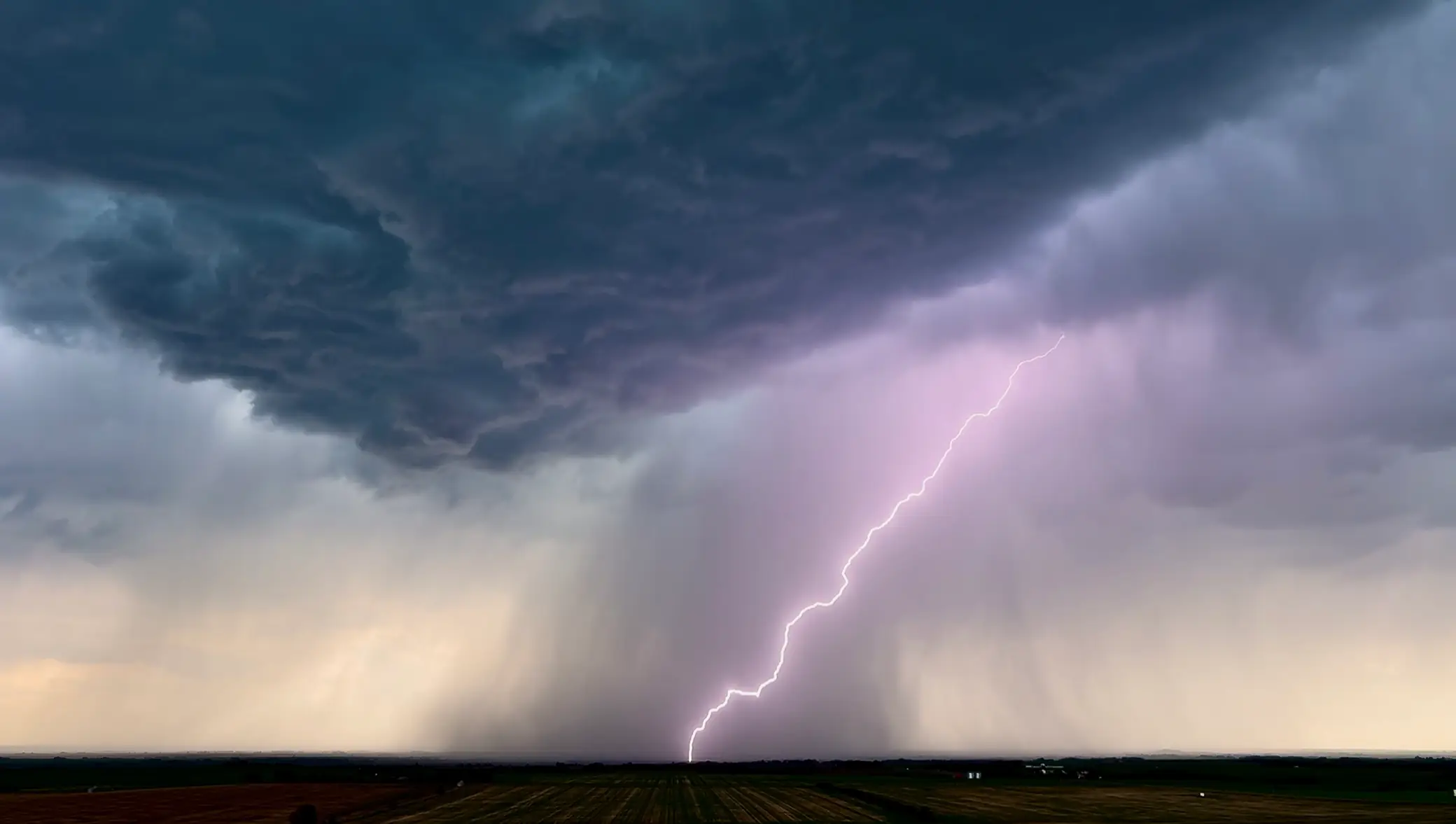
How Our Hailstorm Prediction Algorithm Works

Updated: June 19, 2026

Understanding the ConvectAlert HailNow hailstorm detection system

Hailstone in hand showing the size and structure of hailstones
Tennis ball sized hailstones collected near Lodgepole, AB on July 1, 2025. Hailstones of this size could cause $10,000+ in damages per vehicle hit by them.

Hailstorms are an extremely costly natural disaster in Canada, occurring mainly during the spring and summer months when weather conditions allow for the development of powerful thunderstorms. These thunderstorms in turn form hailstones, which are dense balls of ice that fall to the ground, often causing significant property damage. Alberta is known as the hail capital of Canada, experiencing by far the most hailstorms, however there are currently a lack of resources being dedicated to the prediction, detection, and mitigation of the damage caused by hailstorms.

ConvectAlert Analytics was created to bring better weather data to Canadians. By bridging the gap between the information that skilled meteorologists have access to, and the general public, ConvectAlert brings actionable weather data to Canadian businesses in a way that you don't have to be an atmospheric scientist to understand.

The objective of this demo is to show how ConvectAlert's HailNow Alert Service works. The service is just one of the ways ConvectAlert aims to reduce severe weather damage for businesses, however it's fundamental to providing advance warning of incoming hailstorms, allowing businesses to activate severe weather plans and reduce preventable hail damage.
Background

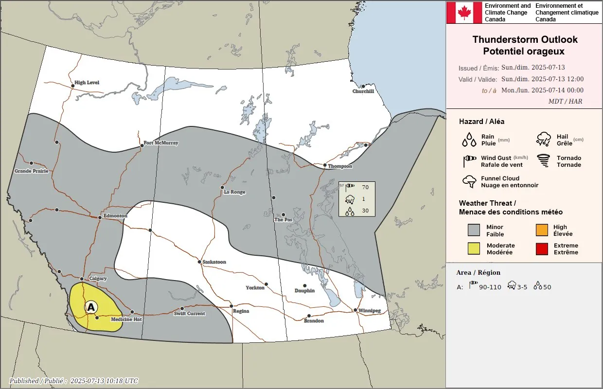
July 13, 2025 was a typical summer day in Southern Alberta, with warm and humid conditions, leading weather forecasters to anticipate a risk for severe thunderstorms roughly from Calgary down towards the Montana border, as is shown in the map above. While it wasn't predicted to be an especially dangerous day for thunderstorms, weather models were in very good agreement about severe thunderstorms occurring somewhere within the Calgary-Lethbridge corridor.

ECCC weather map for July 13, 2025
Environment and Climate Change Canada severe weather outlook map showing the anticipated severe weather on July 13, 2025.

July 13 Progression

Around noon on July 13th, a severe thunderstorm watch was issued for Calgary, with tornado watches being issued to the south of the city. This was the first real storm risk communicated to the general public, however with it being the third severe thunderstorm issued for Calgary up to that point in the 2025 storm season, it wasn't cause for alarm yet.

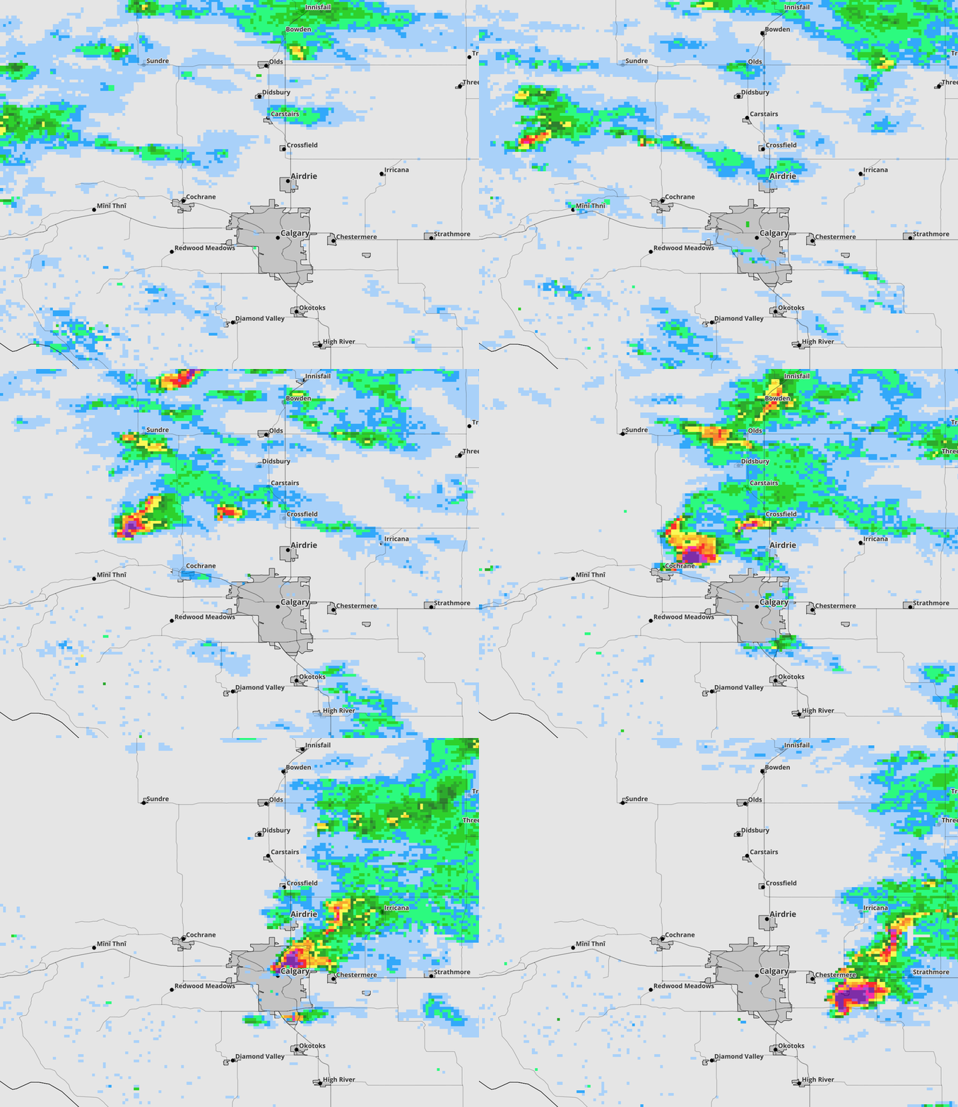
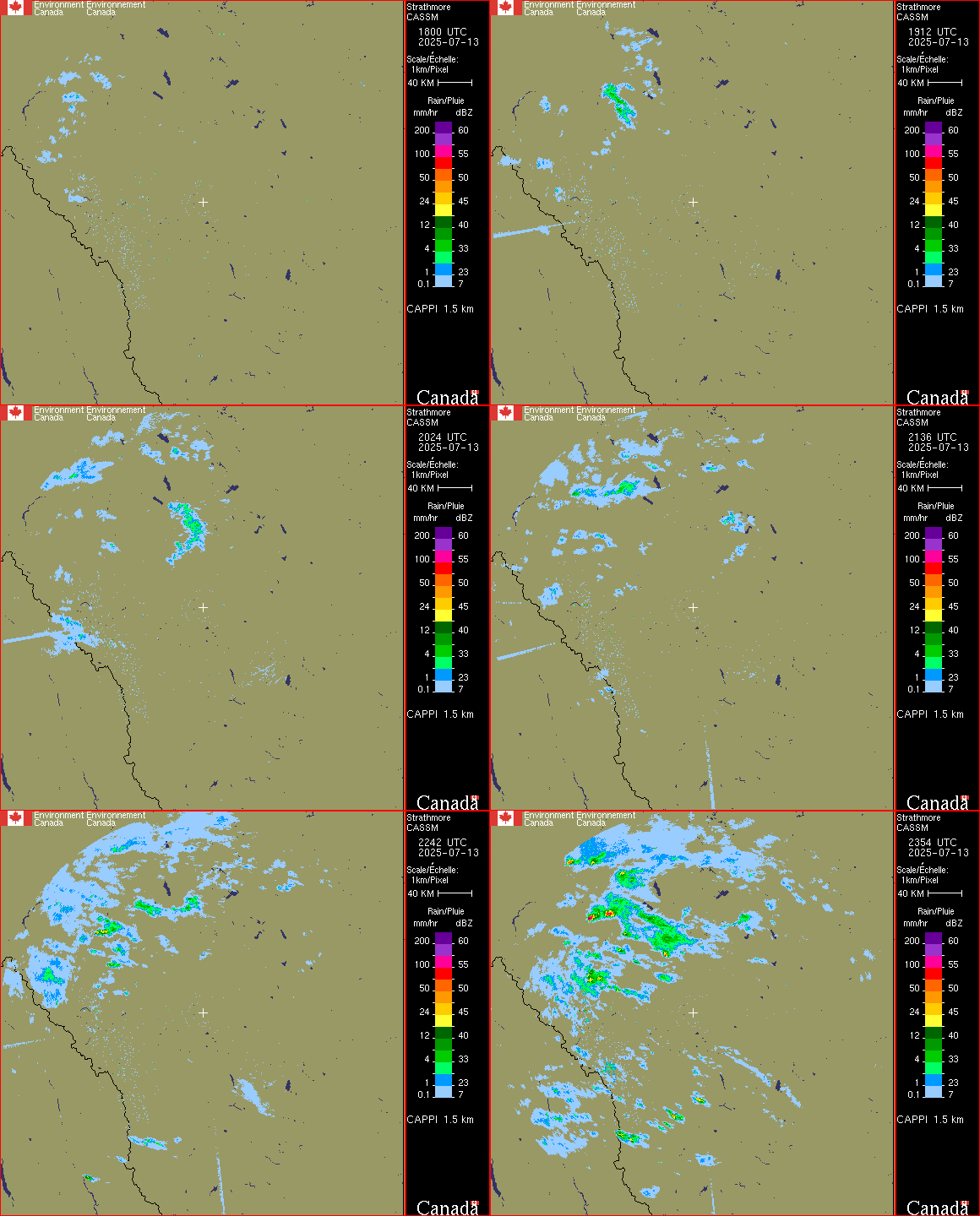
CASSM radar progression for July 13 up until storm initiation time
Radar data from the Strathmore weather radar between 12pm and 6pm. Scattered showers (shown in blue & green) can be seen approaching Calgary from the NW towards the end of the gif.

Given the modelled weather conditions on July 13th, any storm forming near Waiparous (NW of Calgary) should've been a significant cause for concern as its track would take it right through Calgary. This became increasingly clear around 6:30pm when the storm intensified significantly and began tracking right towards Calgary.

Radar progression map for July 13 storm
This animated sequence shows radar frames from when the storm initiated through its passage over Calgary, displaying weather radar data. The pink and purple pixels are where hail likely occurred.

ConvectAlert HailNow Alert Service

Our alert service operates by continuously monitoring real-time radar data and applying our detection algorithm to identify storms that meet specific criteria for hail production potential. When a storm is detected that exceeds our predefined thresholds for creating alert polygons, the system begins tracking the storm's movement and characteristics. The system issues actual alerts when the storm's intensity and predicted path indicate a high probability of significant hail impact on protected areas, allowing businesses and property owners to take protective action with sufficient lead time.

The triggering thresholds for creating polygons are based on a combination of radar reflectivity values, storm structure indicators, and environmental parameters that suggest the storm is capable of producing hail. For actually issuing alerts, the system requires that the storm not only meets the polygon creation criteria but also shows sustained intensity and a predicted path that intersects with areas of interest, ensuring that alerts are only sent when there is a genuine threat.

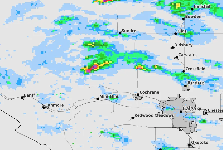
Early storm progression radar frame
This radar frame shows the early stages of the storm that hit Calgary as it began to intensify. No alert has been issued yet as the storm is too new, and therefore highly unpredictable. Thunderstorms often change the direction in which they're moving as they intensify, so issuing alerts as soon as storms form is not ideal.
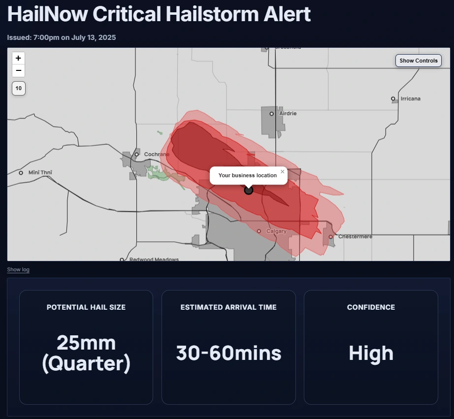
Prime example of alert issuance with business location marked
An actual screenshot from the ConvectAlert HailNow page generated for the business at the location in Beddington Heights shown. This is the map that a customer might receive, where it'd be tailored to their exact business location.

This image shows the actual map view from the July 13, 2025 storm as it approached Calgary. At this time the hailstorm was still in its early stages of development north of Cochrane and wasn't producing significant damaging hail impacts yet.

Let's assume you have a business at the location shown in Beddington Heights on the map. You'd likely receive a text message from ConvectAlert just after 7:00pm containing a link that'd send you to this page. Once on the alert page, you can interact with the map to more clearly see where your business stands in relation to the potential hailstorm impact areas.

Upon receiving this information, a business may decide to implement its severe weather action plan. This could include preventative measures such as moving unsheltered vehicles indoors, offsite, or alerting staff of impending hail risk.

Text Message Alerts

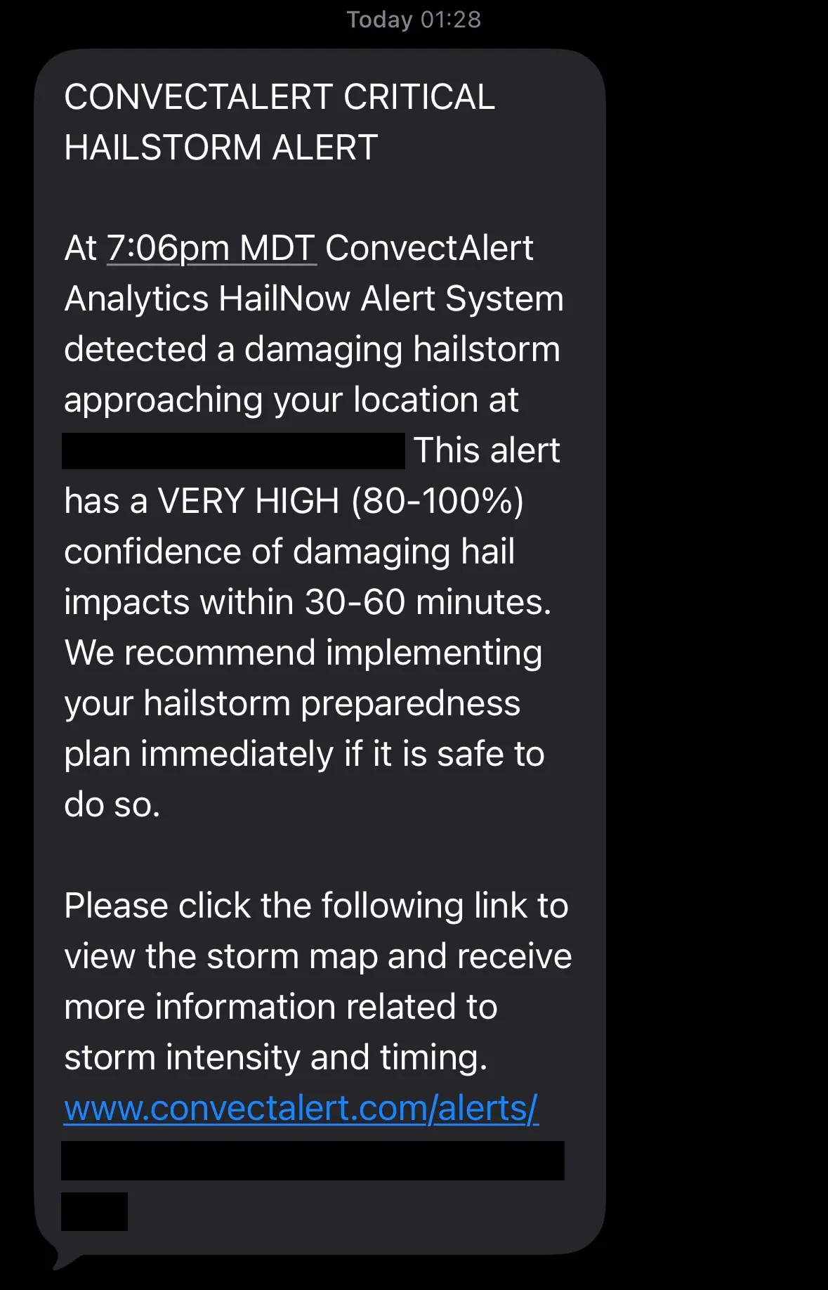
Text message alert about approaching hailstorm on phone
Example of a text message someone within the warning area shown above may receive from ConvectAlert.

In order to get as far as sending you weather alert, ConvectAlert does a significant amount of analysis on the weather data to ensure the alert is justified. Criteria such as the storm intensity, size, and hail damage potential are all considered when determining whether it's likely that any given area will be impacted by a hailstorm. A text alert will only be sent out to customers when ConvectAlert deems there to be a significant risk of the customer's immediate area being impacted by a hailstorm, typically within the next hour or two.

ConvectAlert's HailNow System uses our proprietary algorithm, which weights numerous different data sources in near-real-time. Our system functions autonomously, meaning that data is analyzed almost immediately once it's available, reducing lead times and reliance on human interpretation, which can be subject to inconsistency.

It's important to note that our alerts do not serve as a replacement or substitute to official weather alerts, such as those from Environment and Climate Change Canada (ECCC), but rather we operate a premium "heads up" service that's intended to notify businesses of approaching severe weather so that they can activate their own internal severe weather protocols.

Due to the unpredictable nature of the weather, our service will never be 100% accurate in predicting the future, however we strive to deliver alerts that are of high enough accuracy to be worth taking action over. It's also worth noting that predicted storm tracks, and especially the arrival time predictions should be taken with a grain of salt, as they can only be as accurate as the granular datasets they're built off, which often have resolutions measured in kilometres.

HailNow Alert Service Applications

  • Car dealerships: Dealerships using the HailNow alerting system can use the advance notice to deploy temporary car covers to protect vehicles from hail damage.
  • Aviation businesses: Aircraft operators can stow, cover, or move aircraft from at-risk areas.
  • Outdoor events: Earlier warning of approaching storms allows event organizers to activate thunderstorm protocols sooner, allowing for safer and more timely action to protect attendees and equipment.
  • Construction companies: Activities like concrete pours can be postponed well in advance of approaching storms, additionally hail-sensitive equipment and materials can be moved to reduce hail damages.

Higher-quality weather alerts has many applications across many industries which suffer impacts from severe weather. In many cases simply having 15 extra minutes of advance warning can have a significant impact on the types and degree of action that can be taken to reduce hail damage, or prevent it altogether.

Our HailNow Alert Service takes a new approach to weather alerts, providing more accurate, precise and timely notifications than traditional weather providers. Rather than making guesses based off vague, imprecise publicly available weather forecasts, ConvectAlert provides businesses with professional and actionable weather information, without being overly technical.

HailNow alerts can be tailored for different levels of protection and business needs, whether that's critical alerts only, or alerts days in advance of severe weather potential, or both. We recommend the highest level of protection for businesses such as car dealerships or aircraft operators which may suffer millions in dollars in preventable damages from a single hailstorm. Lower levels of protection may be suitable for businesses willing to take more risk, or those requiring only basic levels of protection.

Conclusion

Picture of a hailstone

False alarms are costing you money

Warning fatigue is a real thing in Alberta. Under the current weather alert regime, many regions can experience half a dozen or more severe thunderstorm warnings per year, while often not experiencing a single damaging hailstorm impact. This warning system contributes to a culture of complacency when it comes to weather alerts, which can worsen the damages when a damaging hailstorm does eventually occur.

ConvectAlert Analytics' goal is to drastically reduce instances of false alarms for weather alerts. We believe that if businesses can build a culture of action around weather alerts, then that can directly lead to operational and financial benefits.

Missed alerts are unacceptable

Being unprepared for a hailstorm's impacts could cost you millions. Even if the confidence of damaging hail impacts is not high yet, our system still prioritizes letting you know, so that you can decide when to start taking action.

Timing is everything

When faced with an approaching hailstorm, every second counts. Through greater preparation, the cost of insurance claims can be reduced, or even avoided entirely. It all comes down to preparation.

Ready to protect your business?

Learn more about how ConvectAlert Analytics can provide customized hailstorm alerts for your operations.